← Year 2 geography worksheets

Year 2 Local area: why is (our place) special? worksheet

“Finding Places with Directions” is free to print, with no account. It is the first sheet in the Year 2 geography unit “Local area: why is (our place) special?”, for children aged 6 to 7, and takes about 23 minutes.

Print it on A4. The child's pages come first; the answers, and what each wrong answer tells you, are on the grown-up page that follows. Weeks 25 to 30 of the year, 6 sheets in the unit.

Free sample · answers on the last page

Finding Places with Directions

Name: ____________ · Date: ____________
Year 2 · Geography · about 23 minutes
Answers are on the grown-up page

Today I can use compass directions and a map to find where places are.

A Look back3 min

  1. 1.

    Which letter is missing from the compass? Circle it.

    NNESESSWWNW
    EPXK
  2. 2.

    Is the tree east or west of the house? Circle it.

    ABCD1234N
    eastwest
  3. 3.

    Is the pond north or south of the house? Circle it.

    ABCD1234~N
    northsouth

B Watch me, then you4 min

Ali's school and the shop are on this map. Which way is the shop from the school?

Watch me
ABCD1234SN

Find the school on the map. It is in square B2.

The shop is one square to the right, in square C2.

Right is east, so the shop is east of the school.

Now you
  1. 1.

    Is the park north or south of the home? Circle it.

    ABCD1234N
    northsouth
  2. 2.

    Which way is the church from the school? Circle it.

    ABCD1234SN
    northsoutheastwest

C Your turn8 min

Use the map to answer. Circle your answer. Each map is a little different.

  1. 1.

    Is the school north or south of the house? Circle it.

    ABCD1234SN
    northsouth
  2. 2.

    Is the shop east or west of the house? Circle it.

    ABCD1234SN
    eastwest
  3. 3.

    Which is further north, the shop or the farm? Circle it.

    ABCD1234N
    the shopthe farm
  4. 4.

    Going from the school, which way is the farm? Circle it.

    ABCD1234SN
    northsoutheastwest

Say it out loud: Which way is the top of the map, and how do you know?

D Spot the mistake3 min

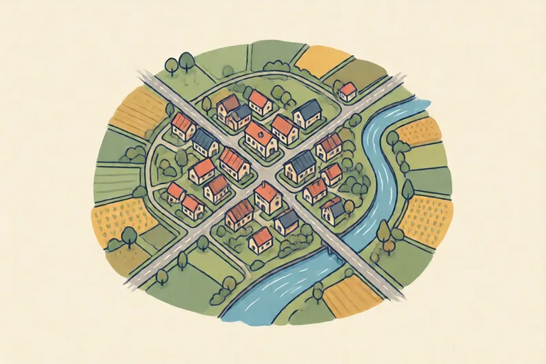
A large-scale map is zoomed in close, like the first picture of the street.
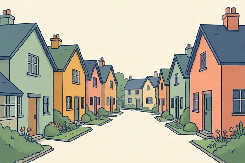
A village street with a row of small houses, seen up closeThe same village seen from high above with roads and fields
Kit says: “A large-scale map shows a big area, like a whole country.”
  1. 1.

    Is Kit right? Explain why in one sentence.

E Think deeper4 min

  1. 1.

    A new visitor has this map but no key. What could go wrong? How would a key help them?

    ABCD1234SN

How did it feel?

I can do it Nearly Not yet
StudyDen · Year 2 · Geography · Local area: why is (our place) special?Answers are on the grown-up page

For the grown-up

Finding Places with Directions · 2 minutes to read

Answers, and what a wrong one tells you

A

1. E If they circle a letter that is not a compass point, ask them to name the four points. Then go round clockwise from north.

2. east If they say west, they may have left and right mixed up. Turn the map so north is at the top, then look to the right.

3. north If they say south, they may think the bottom of the map is the top. Rows go up the side, so higher up means north.

B

1. north If they say south, check which row the park is on. A higher row is further north.

2. east If they say west, they may be starting from the church. Ask them to start at the school and move along the row.

C

1. north If they say south, they may think the bottom of the map is the top. Higher rows are further north.

2. east If they say west, they may have turned the map round. The shop is to the right of the house, so it is east.

3. the farm If they choose the shop, they may think the bottom of the map is the top. The farm is higher up the side, so it is further north.

4. east If they say north, they may have looked at the height of the farm. Start at the school, then look along the same row to the right.

D

1. Look for: Says no, and that the map shows one small place in close detail. If they agree, ask what the close-up picture shows. Zoomed in means a small place, shown in lots of detail.

E

1. Look for: Says the visitor might not know what a symbol means, and that a key explains each symbol.

Words to use

Say“Which way is north on this map? How do you know?”
Instead of“Just tell them where the shop is.”

After the sheet

Draw your street with a star for home and a square for a shop, then say which way the shop is.

Tick what your child got right in StudyDen. Anything missed comes back in a later Look back box, so there's no need to redo the sheet.

The rest of this unit

5 more sheets come with a StudyDen plan, in teaching order:

  1. Features of Our Place(with a plan)
  2. Mapping my local places(with a plan)
  3. Weather or climate?(with a plan)
  4. Landmarks near and far(with a plan)
  5. Using our senses outside(with a plan)

Every Year 2 geography worksheet

The worksheets plan opens a printable sheet for every lesson in Years 1 to 6, each with its answers on a separate page for you. It costs £6.99 a month or £59 a year for the whole family, with no free trial.

The full StudyDen plan adds the lessons themselves, marked as your child works, with the worksheets included. It is 7 days free, then £29.99 a month.

Both start with a free account; you choose the plan when you sign up.